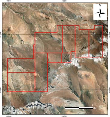
Prospecto Las Heladas — Epitermal HS Au, Atacama
Tierra Amarilla, Atacama, Chile
BASIC EXPLORATION
12 Aug 2026
View opportunity
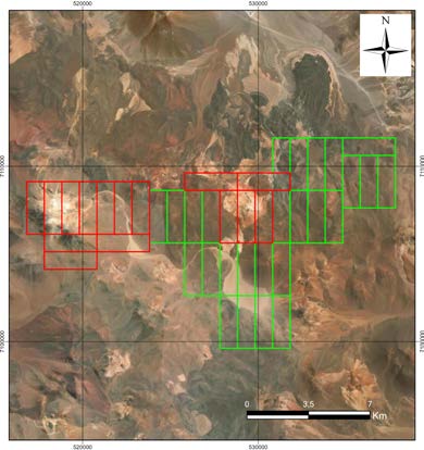
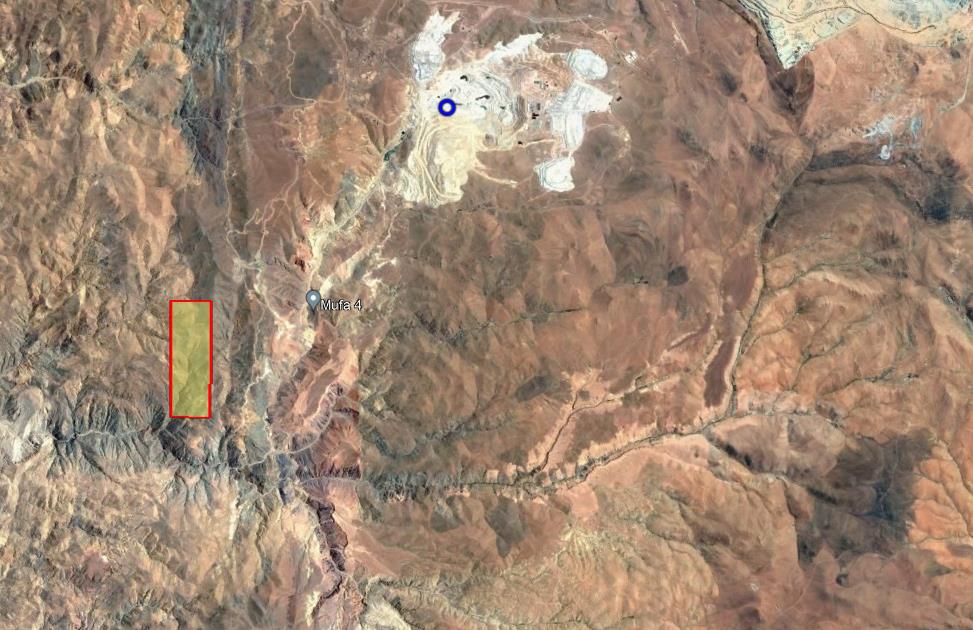
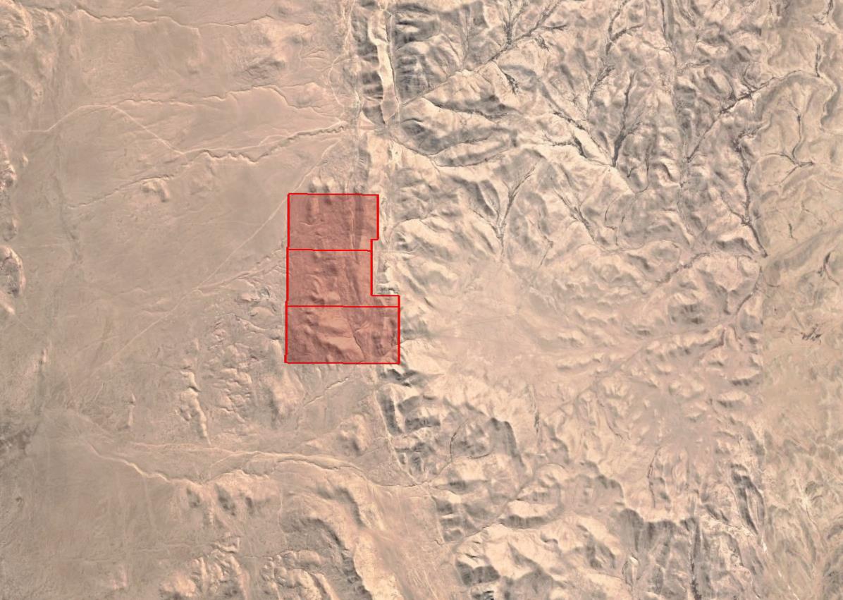
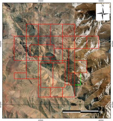
Prospecto Las Pintadas es un yacimiento epitermal de oro en etapa de exploración básica ubicado en la Región de Atacama, aproximadamente 100 km al sureste de Copiapó, dentro de la Franja Metalogénica del Mioceno temprano-medio. La mineralización se asocia a la falla Caspiche y comprende potenciales cuerpos diseminados de oro y cobre en estructuras vetiformes con alteración hidrotermal evidente. El muestreo geoquímico de superficie ha identificado anomalías de Au, Zn, Pb, As y Hg, indicando mineralización de metales preciosos en un distrito de elevaciones entre 2.990 m y 4.068 m.
Prospecto epitermal HS en exploración básica con anomalías de Au en alteración hidrotermal asociada a falla Caspiche, Atacama
Prospecto epitermal de oro de alta sulfuración en exploración básica, Región de Atacama
Chilean concession: two types can coexist (exploration / exploitation).
| # | Name | Type | Area |
|---|---|---|---|
| 1 | DORADO 27 1-20 | Exploitation | 200 ha |
Holder in the mining cadastre: SCM LAS PINTADAS ENAMI lists it in its portfolio; the Sernageomin mining cadastre records it under another holder. The legal area is the cadastre's: 200 ha (rol 032033579). Source: Sernageomin mining cadastre as of 25 Oct 2026 · ENAMI layer as of 12 Aug 2026 | |||
| 2 | LAS PINTADAS 28C | Exploitation | 100.08 ha* |
Expired with no extension published, as of 14 Sep 2026 The Sernageomin mining cadastre records no extension and no later status. We do not state that it is extinct. * Area calculated from the polygon published by ENAMI, not verified in the cadastre Source: Sernageomin mining cadastre as of 4 Oct 2026 · ENAMI layer as of 12 Aug 2026 | |||
| 3 | LAS PINTADAS 5, 1-10 | Exploitation | 100 ha |
| 4 | LAS PINTADAS 17, 1/20 | Exploitation | 130 ha |
Holder in the mining cadastre: SCM LAS PINTADAS ENAMI lists it in its portfolio; the Sernageomin mining cadastre records it under another holder. The legal area is the cadastre's: 130 ha (rol 032015591). Source: Sernageomin mining cadastre as of 25 Oct 2026 · ENAMI layer as of 12 Aug 2026 | |||
| 5 | LAS PINTADAS 18, 1/3 | Exploitation | 30 ha |
Holder in the mining cadastre: SCM LAS PINTADAS ENAMI lists it in its portfolio; the Sernageomin mining cadastre records it under another holder. The legal area is the cadastre's: 30 ha (rol 032015592). Source: Sernageomin mining cadastre as of 25 Oct 2026 · ENAMI layer as of 12 Aug 2026 | |||
| 6 | LAS PINTADAS 20, 1/5 | Exploitation | 50 ha |
Holder in the mining cadastre: SCM LAS PINTADAS ENAMI lists it in its portfolio; the Sernageomin mining cadastre records it under another holder. The legal area is the cadastre's: 50 ha (rol 032015594). Source: Sernageomin mining cadastre as of 25 Oct 2026 · ENAMI layer as of 12 Aug 2026 | |||
| 7 | LAS PINTADAS 23, 1/5 | Exploitation | 50 ha |
Holder in the mining cadastre: SCM LAS PINTADAS ENAMI lists it in its portfolio; the Sernageomin mining cadastre records it under another holder. The legal area is the cadastre's: 50 ha (rol 032015595). Source: Sernageomin mining cadastre as of 25 Oct 2026 · ENAMI layer as of 12 Aug 2026 | |||
| 8 | LAS PINTADAS 18, 1/10 | Exploitation | 100 ha |
Holder in the mining cadastre: SCM LAS PINTADAS ENAMI lists it in its portfolio; the Sernageomin mining cadastre records it under another holder. The legal area is the cadastre's: 100 ha (rol 032034019). Source: Sernageomin mining cadastre as of 25 Oct 2026 · ENAMI layer as of 12 Aug 2026 | |||
| 9 | LAS PINTADAS 19, 1/10 | Exploitation | 100 ha |
Holder in the mining cadastre: SCM LAS PINTADAS ENAMI lists it in its portfolio; the Sernageomin mining cadastre records it under another holder. The legal area is the cadastre's: 100 ha (rol 032034020). Source: Sernageomin mining cadastre as of 25 Oct 2026 · ENAMI layer as of 12 Aug 2026 | |||
| 10 | LAS PINTADAS 20, 1/10 | Exploitation | 100 ha |
Holder in the mining cadastre: SCM LAS PINTADAS ENAMI lists it in its portfolio; the Sernageomin mining cadastre records it under another holder. The legal area is the cadastre's: 100 ha (rol 032034021). Source: Sernageomin mining cadastre as of 25 Oct 2026 · ENAMI layer as of 12 Aug 2026 | |||
| 11 | LAS PINTADAS 25, 1/9 | Exploitation | 84 ha |
Holder in the mining cadastre: SCM LAS PINTADAS ENAMI lists it in its portfolio; the Sernageomin mining cadastre records it under another holder. The legal area is the cadastre's: 84 ha (rol 032034022). Source: Sernageomin mining cadastre as of 25 Oct 2026 · ENAMI layer as of 12 Aug 2026 | |||
| 12 | DORADO 28 1-20 | Exploitation | 200 ha |
Holder in the mining cadastre: SCM LAS PINTADAS ENAMI lists it in its portfolio; the Sernageomin mining cadastre records it under another holder. The legal area is the cadastre's: 200 ha (rol 032033580). Source: Sernageomin mining cadastre as of 25 Oct 2026 · ENAMI layer as of 12 Aug 2026 | |||
| 13 | LAS PINTADAS 1, 1-10 | Exploitation | 100 ha |
| 14 | LAS PINTADAS 2, 1-10 | Exploitation | 100 ha |
| 15 | LAS PINTADAS 3, 1-10 | Exploitation | 100 ha |
| 16 | LAS PINTADAS 16, 1/20 | Exploitation | 200 ha |
Holder in the mining cadastre: SCM LAS PINTADAS ENAMI lists it in its portfolio; the Sernageomin mining cadastre records it under another holder. The legal area is the cadastre's: 200 ha (rol 032015590). Source: Sernageomin mining cadastre as of 25 Oct 2026 · ENAMI layer as of 12 Aug 2026 | |||
| 17 | LAS PINTADAS 24, 1/15 | Exploitation | 150 ha |
Holder in the mining cadastre: SCM LAS PINTADAS ENAMI lists it in its portfolio; the Sernageomin mining cadastre records it under another holder. The legal area is the cadastre's: 150 ha (rol 032015596). Source: Sernageomin mining cadastre as of 25 Oct 2026 · ENAMI layer as of 12 Aug 2026 | |||
| 18 | LAS PINTADAS 25, 1/11 | Exploitation | Differs from cadastre |
The area published by ENAMI differs from the mining cadastre Sernageomin mining cadastre: 46 ha (rol 032015597) Source: Sernageomin mining cadastre as of 25 Oct 2026 · the difference from ENAMI exceeds 10% Holder in the mining cadastre: SCM LAS PINTADAS ENAMI lists it in its portfolio; the Sernageomin mining cadastre records it under another holder. The legal area is the cadastre's: 46 ha (rol 032015597). Source: Sernageomin mining cadastre as of 25 Oct 2026 · ENAMI layer as of 12 Aug 2026 | |||
| 19 | LAS PINTADAS 26, 1/8 | Exploitation | 20 ha |
Holder in the mining cadastre: SCM LAS PINTADAS ENAMI lists it in its portfolio; the Sernageomin mining cadastre records it under another holder. The legal area is the cadastre's: 20 ha (rol 032015598). Source: Sernageomin mining cadastre as of 25 Oct 2026 · ENAMI layer as of 12 Aug 2026 | |||
| 20 | LAS PINTADAS 17, 1/10 | Exploitation | 100 ha |
Holder in the mining cadastre: SCM LAS PINTADAS ENAMI lists it in its portfolio; the Sernageomin mining cadastre records it under another holder. The legal area is the cadastre's: 100 ha (rol 032034018). Source: Sernageomin mining cadastre as of 25 Oct 2026 · ENAMI layer as of 12 Aug 2026 | |||
| 21 | LAS PINTADAS 26, 1/2 | Exploitation | 80 ha |
Holder in the mining cadastre: SCM LAS PINTADAS ENAMI lists it in its portfolio; the Sernageomin mining cadastre records it under another holder. The legal area is the cadastre's: 80 ha (rol 032034023). Source: Sernageomin mining cadastre as of 25 Oct 2026 · ENAMI layer as of 12 Aug 2026 | |||
| 22 | LAS PINTADAS 27, 1/10 | Exploitation | 96 ha |
Holder in the mining cadastre: SCM LAS PINTADAS ENAMI lists it in its portfolio; the Sernageomin mining cadastre records it under another holder. The legal area is the cadastre's: 96 ha (rol 032034024). Source: Sernageomin mining cadastre as of 25 Oct 2026 · ENAMI layer as of 12 Aug 2026 | |||
| 23 | PINTADAS 1/8 | Exploitation | 70 ha |
Holder in the mining cadastre: SCM LAS PINTADAS ENAMI lists it in its portfolio; the Sernageomin mining cadastre records it under another holder. The legal area is the cadastre's: 70 ha (rol 032034015). Source: Sernageomin mining cadastre as of 25 Oct 2026 · ENAMI layer as of 12 Aug 2026 | |||
| 24 | PINTADAS 11/20 | Exploitation | 91 ha |
Holder in the mining cadastre: SCM LAS PINTADAS ENAMI lists it in its portfolio; the Sernageomin mining cadastre records it under another holder. The legal area is the cadastre's: 91 ha (rol 032034016). Source: Sernageomin mining cadastre as of 25 Oct 2026 · ENAMI layer as of 12 Aug 2026 | |||
| 25 | PINTADAS 21/30 | Exploitation | 100 ha |
Holder in the mining cadastre: SCM LAS PINTADAS ENAMI lists it in its portfolio; the Sernageomin mining cadastre records it under another holder. The legal area is the cadastre's: 100 ha (rol 032034017). Source: Sernageomin mining cadastre as of 25 Oct 2026 · ENAMI layer as of 12 Aug 2026 | |||
| 26 | DORADO 29 1-20 | Exploitation | 200 ha |
Holder in the mining cadastre: SCM LAS PINTADAS ENAMI lists it in its portfolio; the Sernageomin mining cadastre records it under another holder. The legal area is the cadastre's: 200 ha (rol 032033581). Source: Sernageomin mining cadastre as of 25 Oct 2026 · ENAMI layer as of 12 Aug 2026 | |||
| 27 | LAS PINTADAS 4, 1-5 | Exploitation | 30 ha |
| Total: 27 concessions | 2,727.08 ha | ||
Holder in the mining cadastre: SCM LAS PINTADAS
ENAMI lists it in its portfolio; the Sernageomin mining cadastre records it under another holder. The legal area is the cadastre's: 200 ha (rol 032033579).
Source: Sernageomin mining cadastre as of 25 Oct 2026 · ENAMI layer as of 12 Aug 2026
Expired with no extension published, as of 14 Sep 2026
The Sernageomin mining cadastre records no extension and no later status. We do not state that it is extinct.
* Area calculated from the polygon published by ENAMI, not verified in the cadastre
Source: Sernageomin mining cadastre as of 4 Oct 2026 · ENAMI layer as of 12 Aug 2026
Holder in the mining cadastre: SCM LAS PINTADAS
ENAMI lists it in its portfolio; the Sernageomin mining cadastre records it under another holder. The legal area is the cadastre's: 130 ha (rol 032015591).
Source: Sernageomin mining cadastre as of 25 Oct 2026 · ENAMI layer as of 12 Aug 2026
Holder in the mining cadastre: SCM LAS PINTADAS
ENAMI lists it in its portfolio; the Sernageomin mining cadastre records it under another holder. The legal area is the cadastre's: 30 ha (rol 032015592).
Source: Sernageomin mining cadastre as of 25 Oct 2026 · ENAMI layer as of 12 Aug 2026
Holder in the mining cadastre: SCM LAS PINTADAS
ENAMI lists it in its portfolio; the Sernageomin mining cadastre records it under another holder. The legal area is the cadastre's: 50 ha (rol 032015594).
Source: Sernageomin mining cadastre as of 25 Oct 2026 · ENAMI layer as of 12 Aug 2026
Holder in the mining cadastre: SCM LAS PINTADAS
ENAMI lists it in its portfolio; the Sernageomin mining cadastre records it under another holder. The legal area is the cadastre's: 50 ha (rol 032015595).
Source: Sernageomin mining cadastre as of 25 Oct 2026 · ENAMI layer as of 12 Aug 2026
Holder in the mining cadastre: SCM LAS PINTADAS
ENAMI lists it in its portfolio; the Sernageomin mining cadastre records it under another holder. The legal area is the cadastre's: 100 ha (rol 032034019).
Source: Sernageomin mining cadastre as of 25 Oct 2026 · ENAMI layer as of 12 Aug 2026
Holder in the mining cadastre: SCM LAS PINTADAS
ENAMI lists it in its portfolio; the Sernageomin mining cadastre records it under another holder. The legal area is the cadastre's: 100 ha (rol 032034020).
Source: Sernageomin mining cadastre as of 25 Oct 2026 · ENAMI layer as of 12 Aug 2026
Holder in the mining cadastre: SCM LAS PINTADAS
ENAMI lists it in its portfolio; the Sernageomin mining cadastre records it under another holder. The legal area is the cadastre's: 100 ha (rol 032034021).
Source: Sernageomin mining cadastre as of 25 Oct 2026 · ENAMI layer as of 12 Aug 2026
Holder in the mining cadastre: SCM LAS PINTADAS
ENAMI lists it in its portfolio; the Sernageomin mining cadastre records it under another holder. The legal area is the cadastre's: 84 ha (rol 032034022).
Source: Sernageomin mining cadastre as of 25 Oct 2026 · ENAMI layer as of 12 Aug 2026
Holder in the mining cadastre: SCM LAS PINTADAS
ENAMI lists it in its portfolio; the Sernageomin mining cadastre records it under another holder. The legal area is the cadastre's: 200 ha (rol 032033580).
Source: Sernageomin mining cadastre as of 25 Oct 2026 · ENAMI layer as of 12 Aug 2026
Holder in the mining cadastre: SCM LAS PINTADAS
ENAMI lists it in its portfolio; the Sernageomin mining cadastre records it under another holder. The legal area is the cadastre's: 200 ha (rol 032015590).
Source: Sernageomin mining cadastre as of 25 Oct 2026 · ENAMI layer as of 12 Aug 2026
Holder in the mining cadastre: SCM LAS PINTADAS
ENAMI lists it in its portfolio; the Sernageomin mining cadastre records it under another holder. The legal area is the cadastre's: 150 ha (rol 032015596).
Source: Sernageomin mining cadastre as of 25 Oct 2026 · ENAMI layer as of 12 Aug 2026
The area published by ENAMI differs from the mining cadastre
Sernageomin mining cadastre: 46 ha (rol 032015597)
Source: Sernageomin mining cadastre as of 25 Oct 2026 · the difference from ENAMI exceeds 10%
Holder in the mining cadastre: SCM LAS PINTADAS
ENAMI lists it in its portfolio; the Sernageomin mining cadastre records it under another holder. The legal area is the cadastre's: 46 ha (rol 032015597).
Source: Sernageomin mining cadastre as of 25 Oct 2026 · ENAMI layer as of 12 Aug 2026
Holder in the mining cadastre: SCM LAS PINTADAS
ENAMI lists it in its portfolio; the Sernageomin mining cadastre records it under another holder. The legal area is the cadastre's: 20 ha (rol 032015598).
Source: Sernageomin mining cadastre as of 25 Oct 2026 · ENAMI layer as of 12 Aug 2026
Holder in the mining cadastre: SCM LAS PINTADAS
ENAMI lists it in its portfolio; the Sernageomin mining cadastre records it under another holder. The legal area is the cadastre's: 100 ha (rol 032034018).
Source: Sernageomin mining cadastre as of 25 Oct 2026 · ENAMI layer as of 12 Aug 2026
Holder in the mining cadastre: SCM LAS PINTADAS
ENAMI lists it in its portfolio; the Sernageomin mining cadastre records it under another holder. The legal area is the cadastre's: 80 ha (rol 032034023).
Source: Sernageomin mining cadastre as of 25 Oct 2026 · ENAMI layer as of 12 Aug 2026
Holder in the mining cadastre: SCM LAS PINTADAS
ENAMI lists it in its portfolio; the Sernageomin mining cadastre records it under another holder. The legal area is the cadastre's: 96 ha (rol 032034024).
Source: Sernageomin mining cadastre as of 25 Oct 2026 · ENAMI layer as of 12 Aug 2026
Holder in the mining cadastre: SCM LAS PINTADAS
ENAMI lists it in its portfolio; the Sernageomin mining cadastre records it under another holder. The legal area is the cadastre's: 70 ha (rol 032034015).
Source: Sernageomin mining cadastre as of 25 Oct 2026 · ENAMI layer as of 12 Aug 2026
Holder in the mining cadastre: SCM LAS PINTADAS
ENAMI lists it in its portfolio; the Sernageomin mining cadastre records it under another holder. The legal area is the cadastre's: 91 ha (rol 032034016).
Source: Sernageomin mining cadastre as of 25 Oct 2026 · ENAMI layer as of 12 Aug 2026
Holder in the mining cadastre: SCM LAS PINTADAS
ENAMI lists it in its portfolio; the Sernageomin mining cadastre records it under another holder. The legal area is the cadastre's: 100 ha (rol 032034017).
Source: Sernageomin mining cadastre as of 25 Oct 2026 · ENAMI layer as of 12 Aug 2026
Holder in the mining cadastre: SCM LAS PINTADAS
ENAMI lists it in its portfolio; the Sernageomin mining cadastre records it under another holder. The legal area is the cadastre's: 200 ha (rol 032033581).
Source: Sernageomin mining cadastre as of 25 Oct 2026 · ENAMI layer as of 12 Aug 2026
Areas: Sernageomin mining cadastre as of 25 Oct 2026 unless noted · * measured on the polygon published by ENAMI; not the legal area
Information provided by the seller. Not independently verified by Mercado Minero except where indicated. This is not investment advice.