Raquel – Magdalena Mining Project
Provincia de Petorca, Valparaíso, Chile
ADVANCED EXPLORATION
USD 800KAcquisition +8
18 Aug 2026
View opportunity
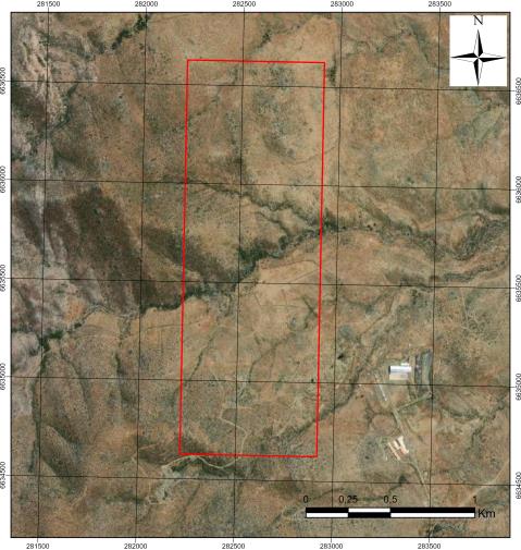
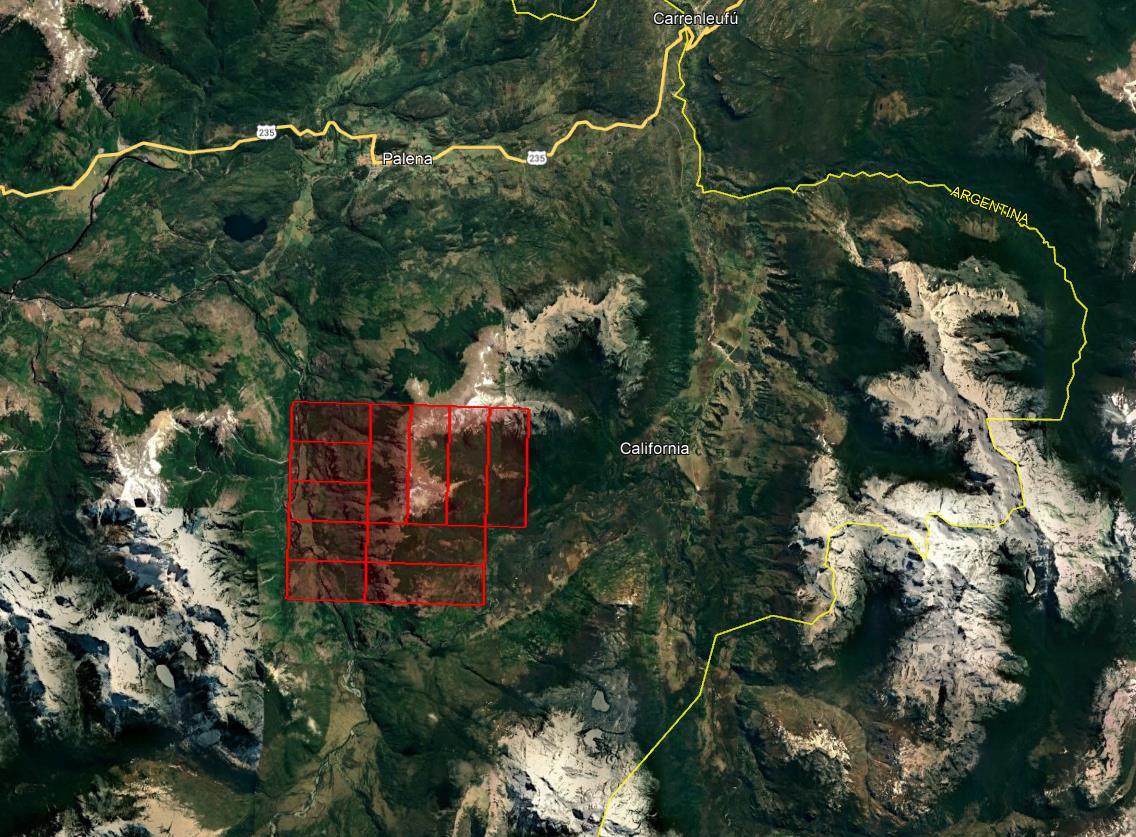
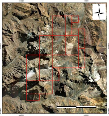
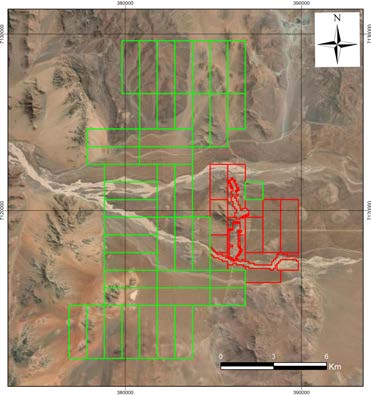
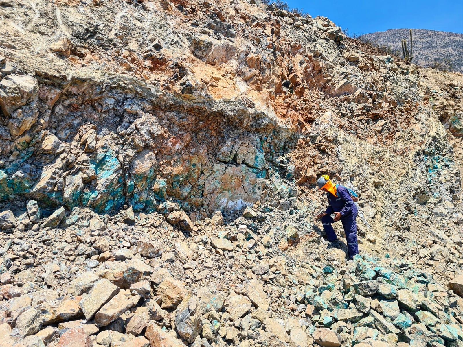
Prospecto Pastenes es un yacimiento de tipo IOCG (óxido de hierro-cobre-oro) en etapa de exploración avanzada ubicado en la Región de Atacama, dentro de un distrito minero de la Franja Metalogénica del Cretácico Inferior que hospeda depósitos IOCG, estratoligados y skarn. La mineralización se presenta asociada a estructuras verticales mineralizadas en cobre, oro y plata, con cuerpos de tipo vetas y bolsones distribuidos en un rango altitudinal entre 777 y 1.393 metros. Los estudios de polarización inducida revelan respuestas anómalas focalizadas a profundidad en dirección NW-SE, mientras que la magnetometría identifica anomalías de elevada intensidad organizadas en fajas y lineamientos con orientaciones NE-SW, NW-SE y N-S, que sustentan la interpretación del sistema mineralizado.
Prospecto IOCG Cu-Au en exploración avanzada con anomalías geofísicas focalizadas en dirección NW-SE
Yacimiento IOCG de cobre-oro en exploración avanzada, Región de Atacama
Chilean concession: two types can coexist (exploration / exploitation).
| # | Name | Type | Area |
|---|---|---|---|
| 1 | PASTENES OESTE 6D | Exploration | 100 ha |
| 2 | PASTENES OESTE 15D | Exploration | 300 ha |
| 3 | PASTENES NORTE 1D | Exploration | 300 ha |
| 4 | PASTENES NORTE 2D | Exploration | 300 ha |
| 5 | PASTENES NORTE 3D | Exploration | 300 ha |
| 6 | PASTENES NORTE 4D | Exploration | 300 ha |
| 7 | PASTENES NORTE 5D | Exploration | 300 ha |
| 8 | PASTENES NORTE 6D | Exploration | 300 ha |
| 9 | PASTENES NORTE 7D | Exploration | 300 ha |
| 10 | PASTENES NORTE 8D | Exploration | 200 ha |
| 11 | PASTENES NORTE 9D | Exploration | 200 ha |
| 12 | PASTENES NORTE 10D | Exploration | 200 ha |
| 13 | PASTENES NORTE 11D | Exploration | 300 ha |
| 14 | PASTENES NORTE 12D | Exploration | 300 ha |
| 15 | PASTENES OESTE 16D | Exploration | 300 ha |
| 16 | PASTENES OESTE 22C | Exploration | 300 ha |
Linked by polygon (different name in ENAMI: «PASTENES OESTE 22C») In the Sernageomin mining cadastre: «PASTENES OESTE 22D» · rol 031018910 · the polygons overlap by 95% or more in both directions Source: Sernageomin mining cadastre as of 25 Oct 2026 | |||
| 17 | PASTENES OESTE 21C | Exploration | 300 ha |
Linked by polygon (different name in ENAMI: «PASTENES OESTE 21C») In the Sernageomin mining cadastre: «PASTENES OESTE 21D» · rol 031018909 · the polygons overlap by 95% or more in both directions Source: Sernageomin mining cadastre as of 25 Oct 2026 | |||
| 18 | PASTENES OESTE 24C | Exploration | 300 ha |
Linked by polygon (different name in ENAMI: «PASTENES OESTE 24C») In the Sernageomin mining cadastre: «PASTENES OESTE 24D» · rol 031018912 · the polygons overlap by 95% or more in both directions Source: Sernageomin mining cadastre as of 25 Oct 2026 | |||
| 19 | PASTENES OESTE 23C | Exploration | 300 ha |
Linked by polygon (different name in ENAMI: «PASTENES OESTE 23C») In the Sernageomin mining cadastre: «PASTENES OESTE 23D» · rol 031018911 · the polygons overlap by 95% or more in both directions Source: Sernageomin mining cadastre as of 25 Oct 2026 | |||
| 20 | PASTENES OESTE 17D | Exploration | 200 ha |
| 21 | PASTENES OESTE 25C | Exploration | 300 ha |
Linked by polygon (different name in ENAMI: «PASTENES OESTE 25C») In the Sernageomin mining cadastre: «PASTENES OESTE 25D» · rol 031018913 · the polygons overlap by 95% or more in both directions Source: Sernageomin mining cadastre as of 25 Oct 2026 | |||
| 22 | PASTENES OESTE 20C | Exploration | 300 ha |
Linked by polygon (different name in ENAMI: «PASTENES OESTE 20C») In the Sernageomin mining cadastre: «PASTENES OESTE 20D» · rol 031018908 · the polygons overlap by 95% or more in both directions Source: Sernageomin mining cadastre as of 25 Oct 2026 | |||
| 23 | PASTENES OESTE 18D | Exploration | 200 ha |
| 24 | PASTENES OESTE 4D | Exploration | 300 ha |
| 25 | PASTENES OESTE 26C | Exploration | 300 ha |
Linked by polygon (different name in ENAMI: «PASTENES OESTE 26C») In the Sernageomin mining cadastre: «PASTENES OESTE 26D» · rol 031018914 · the polygons overlap by 95% or more in both directions Source: Sernageomin mining cadastre as of 25 Oct 2026 | |||
| 26 | PASTENES OESTE 12D | Exploration | 300 ha |
| 27 | PASTENES OESTE 10D | Exploration | 300 ha |
| 28 | PASTENES OESTE 11D | Exploration | 300 ha |
| 29 | PASTENES OESTE 5D | Exploration | 300 ha |
| 30 | PASTENES NORTE 13D | Exploration | 200 ha |
| 31 | PASTENES ALFA 1 | Exploration | 300 ha |
| 32 | PASTENES ALFA 3 | Exploration | 300 ha |
| 33 | PASTENES ALFA 5 | Exploration | 300 ha |
| 34 | PASTENES ALFA 7 | Exploration | 300 ha |
| 35 | PASTENES ALFA 9 | Exploration | 300 ha |
| 36 | PASTENES ALFA 11 | Exploration | 300 ha |
| 37 | PASTENES ALFA 13 | Exploration | 300 ha |
| 38 | PASTENES ALFA 15 | Exploration | 300 ha |
| 39 | PASTENES ALFA 17 | Exploration | 300 ha |
| 40 | PASTENES ALFA 18 | Exploration | 300 ha |
| 41 | PASTENES ALFA 19 | Exploration | 300 ha |
| 42 | PASTENES ALFA 20 | Exploration | 300 ha |
| Total: 42 concessions | 11,800 ha | ||
Linked by polygon (different name in ENAMI: «PASTENES OESTE 22C»)
In the Sernageomin mining cadastre: «PASTENES OESTE 22D» · rol 031018910 · the polygons overlap by 95% or more in both directions
Source: Sernageomin mining cadastre as of 25 Oct 2026
Linked by polygon (different name in ENAMI: «PASTENES OESTE 21C»)
In the Sernageomin mining cadastre: «PASTENES OESTE 21D» · rol 031018909 · the polygons overlap by 95% or more in both directions
Source: Sernageomin mining cadastre as of 25 Oct 2026
Linked by polygon (different name in ENAMI: «PASTENES OESTE 24C»)
In the Sernageomin mining cadastre: «PASTENES OESTE 24D» · rol 031018912 · the polygons overlap by 95% or more in both directions
Source: Sernageomin mining cadastre as of 25 Oct 2026
Linked by polygon (different name in ENAMI: «PASTENES OESTE 23C»)
In the Sernageomin mining cadastre: «PASTENES OESTE 23D» · rol 031018911 · the polygons overlap by 95% or more in both directions
Source: Sernageomin mining cadastre as of 25 Oct 2026
Linked by polygon (different name in ENAMI: «PASTENES OESTE 25C»)
In the Sernageomin mining cadastre: «PASTENES OESTE 25D» · rol 031018913 · the polygons overlap by 95% or more in both directions
Source: Sernageomin mining cadastre as of 25 Oct 2026
Linked by polygon (different name in ENAMI: «PASTENES OESTE 20C»)
In the Sernageomin mining cadastre: «PASTENES OESTE 20D» · rol 031018908 · the polygons overlap by 95% or more in both directions
Source: Sernageomin mining cadastre as of 25 Oct 2026
Linked by polygon (different name in ENAMI: «PASTENES OESTE 26C»)
In the Sernageomin mining cadastre: «PASTENES OESTE 26D» · rol 031018914 · the polygons overlap by 95% or more in both directions
Source: Sernageomin mining cadastre as of 25 Oct 2026
Areas: Sernageomin mining cadastre as of 25 Oct 2026 unless noted
Information provided by the seller. Not independently verified by Mercado Minero except where indicated. This is not investment advice.