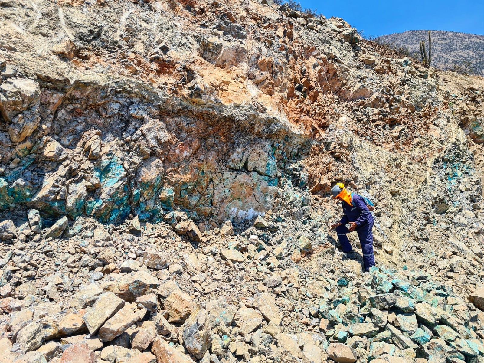
Raquel – Magdalena Mining Project
Provincia de Petorca, Valparaíso, Chile
ADVANCED EXPLORATION
USD 800KAcquisition +8
18 Aug 2026
View opportunity
Prospecto Blanco es un yacimiento epitermal de cobre en etapa de exploración básica ubicado en la Región de Atacama, Chile. El área presenta una secuencia geológica compuesta por rocas sedimentarias calcáreas del Jurásico (Formación Lautaro) y rocas volcánicas del Cretácico superior (Estratos de Sierras Los Leones), intruidas por el plutón El Gato de edad Eoceno. La mineralización corresponde a un tipo "Sílica Cap" epitermal de alta sulfuración con contenidos de cobre, oro y plata, controlada por un sistema de fallas extensivas de rumbo norte-sur que facilitó el ascenso de soluciones hidrotermales desde el plutón El Gato. La presencia de calderas y la intensa actividad tectónica regional conforman un entorno metalogénico de interés para la exploración de depósitos epitermales.
Prospecto epitermal Cu-Au tipo Sílica Cap con sistema de fallas extensivas favorables en exploración básica, Atacama
Prospecto epitermal de cobre de alta sulfuración en exploración básica, Región de Atacama
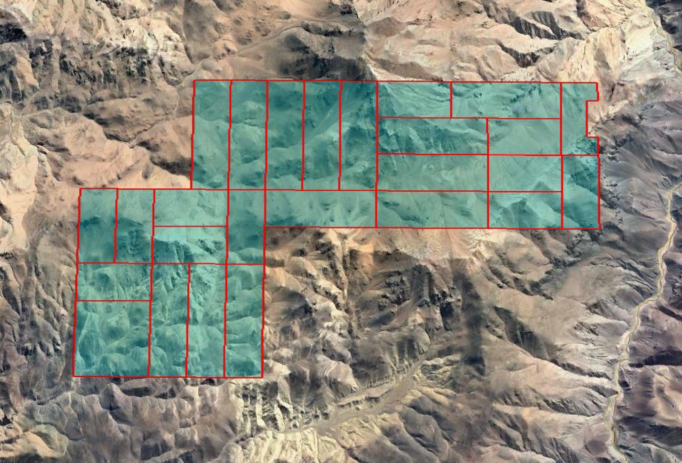
Chilean concession: two types can coexist (exploration / exploitation).
| # | Name | Type | Area |
|---|---|---|---|
| 1 | BLANCO DIECISIETE 1-30 | Exploitation | 300 ha |
| 2 | BLANCO DIECIOCHO 1-30 | Exploitation | 300 ha |
| 3 | BLANCO DIECINUEVE 1-20 | Exploitation | 200 ha |
| 4 | BLANCO VEINTE 1-20 | Exploitation | 200 ha |
| 5 | BLANCO VEINTIUNO 1-20 | Exploitation | Differs from cadastre |
The area published by ENAMI differs from the mining cadastre Sernageomin mining cadastre: 200 ha (rol 032036567) Source: Sernageomin mining cadastre as of 25 Oct 2026 · the difference from ENAMI exceeds 10% | |||
| 6 | BLANCO VEINTIDOS 1-20 | Exploitation | 200 ha |
| 7 | BLANCO VEINTITRES 1-30 | Exploitation | 300 ha |
| 8 | BLANCO VEINTICUATRO 1-20 | Exploitation | 200 ha |
| 9 | BLANCO DIEZ 1-30 | Exploitation | 300 ha |
| 10 | BLANCO ONCE 1-30 | Exploitation | 300 ha |
| 11 | BLANCO DOCE 1-30 | Exploitation | 300 ha |
| 12 | BLANCO TRECE 1-30 | Exploitation | 300 ha |
| 13 | BLANCO CATORCE 1-30 | Exploitation | 300 ha |
| 14 | BLANCO UNO 1-20 | Exploitation | 200 ha |
| 15 | BLANCO DOS 1-20 | Exploitation | 200 ha |
| 16 | BLANCO TRES 1-30 | Exploitation | 300 ha |
| 17 | BLANCO CUATRO 1-30 | Exploitation | 300 ha |
| 18 | BLANCO DIECISEIS 1-30 | Exploitation | 300 ha |
| 19 | BLANCO VEINTICINCO 1-20 | Exploitation | 170 ha |
Linked by polygon (different name in ENAMI: «BLANCO VEINTICINCO 1-20») In the Sernageomin mining cadastre: «BLANCO 25 1/18» · rol 032036571 · the polygons overlap by 95% or more in both directions Source: Sernageomin mining cadastre as of 25 Oct 2026 | |||
| 20 | BLANCO SEIS 1/40 | Exploitation | 400 ha |
| 21 | BLANCO CINCO 1-20 | Exploitation | 200 ha |
| 22 | BLANCO SEIS 1-20 | Exploitation | 200 ha |
| 23 | BLANCO SIETE 1-20 | Exploitation | 200 ha |
| 24 | BLANCO OCHO 1-20 | Exploitation | 200 ha |
| 25 | BLANCO NUEVE 1-30 | Exploitation | 300 ha |
| 26 | BLANCO QUINCE 1-30 | Exploitation | 300 ha |
| Total: 26 concessions | 6,670 ha | ||
The area published by ENAMI differs from the mining cadastre
Sernageomin mining cadastre: 200 ha (rol 032036567)
Source: Sernageomin mining cadastre as of 25 Oct 2026 · the difference from ENAMI exceeds 10%
Linked by polygon (different name in ENAMI: «BLANCO VEINTICINCO 1-20»)
In the Sernageomin mining cadastre: «BLANCO 25 1/18» · rol 032036571 · the polygons overlap by 95% or more in both directions
Source: Sernageomin mining cadastre as of 25 Oct 2026
Areas: Sernageomin mining cadastre as of 25 Oct 2026 unless noted
Information provided by the seller. Not independently verified by Mercado Minero except where indicated. This is not investment advice.